Wartime Co. Londonderry

Co. Londonderry was an important Allied position during the Second World War. Following the Battle of the Atlantic, U-Boats surrendered at Lisahally.

County Londonderry

Northern Ireland

Co. Londonderry or Co. Derry takes its name from 'Daire' or 'Doire', the Irish word for an oak grove. The name of both the city and county of Derry/Londonderry has been a matter of political debate for centuries. Covering an area of around 2,074 square kilometres, it shares borders with Co. Tyrone to the south-west and Co. Antrim to the east.

During the Second World War, American technicians arrived in Co. Londonderry to begin construction work on bases before the nation officially entered the war. The county boasts the Sperrin Mountains, a range that claimed the lives of many airmen in training incidents. The most significant role played by wartime Derry/Londonderry was as the scene of the U-Boat surrender in 1945.

In general, at WartimeNI, we refer to the city as ‘Derry/Londonderry’ and the county as ‘Co. Londonderry’. Many wartime records from the United States will simply refer to both as ‘Derry’.

German U-boat crew at Lisahally, Co. Londonderry

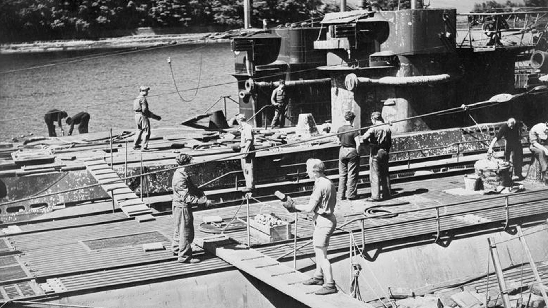
Imperial War Museum Photo: A 28898 (Part of the Admiralty Official Collection). A German U-boat crew unloads ammunition and supplies before Operation Deadlight in Lisahally in Co. Londonderry on 14th May 1945. Copyright Lieutenant C.H. Parnall.

Places of Interest

The following places will be of interest to anyone wishing to explore more of the area's Second World War heritage.

Map showing Castledawson, Co. Londonderry during the Second World War

Castledawson, Co. Londonderry during the Second World War

Co. Londonderry

The village of Castledawson, Co. Londonderry marked the end of the Second World War with "large scale and enthusiastic" celebrations.

Map showing Claudy, Co. Londonderry during the Second World War

Claudy, Co. Londonderry during the Second World War

Co. Londonderry

The village of Claudy, Co. Londonderry hosted American Forces during the Second World War including a U.S. Water Supply Company and a Chemical Depot.

Map showing Coleraine, Co. Londonderry during the Second World War

Coleraine, Co. Londonderry during the Second World War

Co. Londonderry

During the Second World War, elements of the British Army based in Coleraine, Co. Londonderry used the surrounding countryside to train in.

Map showing Eglinton, Co. Londonderry during the Second World War

Eglinton, Co. Londonderry during the Second World War

Co. Londonderry

The village of Eglinton, Co. Londonderry stood close to an important airfield during the Second World War. The Royal Navy used it as R.N.A.S. Eglinton.

Map showing Kilrea, Co. Londonderry during the Second World War

Kilrea, Co. Londonderry during the Second World War

Co. Londonderry

On 18th November 1941, residents of Kilrea, Co. Londonderry watched as an R.A.F. Bomber simulated at attack on the local Railway Station.

Map showing Portstewart, Co. Londonderry during the Second World War

Portstewart, Co. Londonderry during the Second World War

Co. Londonderry

During the Second World War, 508th Parachute Infantry Regiment, 82nd Airborne Division, U.S. Army came to Portstewart, Co. Londonderry.

References
  1. Wikipedia